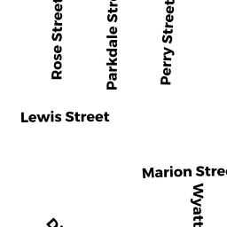
62 MARION ST
Owner Information
COLLINS JOHN F TRUSTEE
62 MARION ST
SOMERVILLE, MA 02143


Property Details
62 MARION ST is classified as a Two-Family Residential (Two family).
The primary structure on this property was built in 1920. There are 2,949ft2 of built area within this property. There is 2,072ft2 of residential/living space within this property. This property is listed as having 9 rooms.
62 MARION ST is valued at $1,033,500. The land is valued at $674,400 and the structures are valued at $359,100.
This property is in Zone NR. Confirm with local Zoning Board authorities to ensure there are no overlays or other easements on this property.
The most recent deed for 62 MARION ST is recorded at the local registrar in Book 69492, Page 220. 62 MARION ST was last sold on Monday, June 26, 2017 for $1.
Assessment data from fiscal year 2021.
Flood Data
According to the FEMA National Flood Hazard Layer, this property does not appear to be in a flood zone. It may also be in an area not yet reviewed. Nonetheless, confirm this information prior to taking any action.
To view the flood hazards around this property, create a FEMA "Firmette" Map of the area around 62 MARION ST.
Broadband Internet Providers
| Provider | Type | Bandwidth (mbps) | |
|---|---|---|---|
| Verizon New England Inc. | DSL | 15 | 1 |
| VSAT Systems, LLC. | Satellite | 2 | 1 |
| HughesNet | Satellite | 25 | 3 |
| Comcast | Cable | 1000 | 35 |
| GCI Communication Corp. | Satellite | 0 | 0 |
| netBlazr Inc | Fixed Wireless | 50 | 50 |
| Starry, Inc. | Fixed Wireless | 200 | 200 |
| RCN | Cable | 1000 | 20 |
| Crown Castle Fiber | Fiber | 0 | 0 |
| RCN | Cable | 500 | 20 |
| Viasat Inc | Satellite | 100 | 3 |
Broadband service provider data from December 2020.
Adjacent Properties
- 64 MARION ST
Two-Family Residential owned by MUNDKUR PRAVIN V & LATA T - 1-4 WYATT CIR
Other, Open Space owned by None - 2 WYATT CIR
Residential Condominium owned by UTAMSINGH CHAMPA - 3 WYATT CIR
Residential Condominium owned by BRUDNO YEVGENY & ALEXEY - 4 WYATT CIR
Residential Condominium owned by BIRNBAUM MICHAEL E - 1 WYATT CIR
Residential Condominium owned by MAROIS ZACHARY M & ELIZABETH G - 30 WYATT ST
Apartments with Four to Eight Units owned by DIAMOND JACOB - 38 WYATT ST
Residential Condominium owned by JOCHNICK DAPHNE - 40 WYATT ST
Residential Condominium owned by BUCKLE MARK - 42 WYATT ST
Two-Family Residential owned by PANG DOMINIC & JEANETTE FOR LIFE - 38-40 WYATT ST
Other, Open Space owned by None